Authorized Terrasolid Partner in Africa and Southern Africa

As an authorized partner for Terrasolid, GESS offers a comprehensive suite of services to our clients which include Sales, Support, Customization, Optimization, and Training related to Terrasolid products.


Contact us for Terrasolid Sales or Support

Required field!
Required field!
Required field!
Required field!
What assistance do you require? Required field!
Required field!

Terrasolid Product Portfolio

Our partnership with Terrasolid enables us to provide intelligent solutions based on point cloud data.

Terrasolid products Summary

  • TerraScan: Versatile software for processing raw airborne or terrestrial scanned laser data (LiDAR). TerraScan efficiently classifies data points, including ground, vegetation, and buildings.
  • TerraModeler: A powerful tool for surface modeling and orthophoto generation from LiDAR and imagery.
  • TerraMatch: Enhance accuracy by comparing and correcting laser data from overlapping flight or drive paths.
  • TerraPhoto: Optimize workflows for imagery data processing.
  • TerraBatch: Automate processing routines for large datasets.
  • TerraStereo: Efficiently view, analyze, and extract features from 3D point clouds.

Our Commitment

  • Integrated Automation: Our solutions contribute to the seamless integration of planning, production, and business processes, resulting in significant time and cost savings.
  • Bentley MicroStation Expertise: As expert users and customization developers of Bentley MicroStation CAD software, we understand the CAD platform on which Terrasolid products operate.
  • Legacy Partnership: GESS has a longstanding history with Bentley, having been a Bentley Partner for over 10 years.

About Terrasolid

Empowering LiDAR Data Analysis: Comprehensive Tools and Modules for Precision Point Cloud Processing within Bentley's MicroStation.

Terrasolid software products are used worldwide for processing of laser point clouds and imagery data from airborne and mobile LiDAR systems. Running inside Bentley’s MicroStation CAD software, Terrasolid offers a variety of tools for viewing, analysing and extracting features from 3D point clouds in an accurate and efficient manner. Additional modules offer workflows for LiDAR sensor calibration and point cloud data correction, surface modelling and orthophoto generation from LiDAR and imagery. Terrasolid software supports LIDAR data from all sources whether airborne, mobile or terrestrial scanners.

Terrasolid Products

TerraScan

Processing of Raw Airborne or Terrestrial Scanned Laser Data

TerraScan is a versatile software package for processing of raw airborne or terrestrial scanned laser data (LiDAR). Operators and other users read-in trajectories and raw data points and classify them into user-defined point classes like ground, vegetation, buildings, etc.


Besides built–in formats, like LAS and TerraScan binary, users can define their own formats for reading-in practically any ASCII-survey files. All processing routines are optimised to reach the highest performance of the workstation. This performance will be easily exceeded if the total data is hundreds or even billions of points. 

In such cases you can divide the data into smaller geographical blocks utilising TerraScan, and automate processing by user-defined macros.


Other Terrasolid product combinations to TerraScan for laser data processing are TerraMatch, TerraModeler, TerraPhoto and TerraSlave.

TerraModeler

Surface Modelling and Terrain Mapping

TerraModeler enables users to create, edit and utilize surface models. TerraModeler creates surface models (TINs) from various sources, such as LiDAR points stored in binary files or loaded in TerraScan, XYZ ASCII files and graphical design elements.


The software offers versatile visualisation options including coloured shaded surfaces, contour lines, grids, coloured triangle nets, elevation texts, slope directions and textured surfaces if used in combination with TerraPhoto).


Additional functionality includes the production of contour lines and lattice models in batch processing, modification of the TIN, creation of profiles, calculation of volumes, calculation of elevation or volume differences between two surface models, several labelling options, and other tools for design purposes.


TerraModeler is a versatile tool for many kinds of design and modelling tasks with various export options functionality.

TerraMatch

Calibration and Strip Adjustment

TerraMatch is a sophisticated tool for improving the accuracy and quality of the raw laser point cloud. It compares laser data from overlapping flight or drive paths and calculates correction values for the misalignment angles as well as XYZ location errors. The comparison and correction value calculation can be either based on surface matching or on different types of tie lines. Tie line matching comprises points or lines on horizontal, vertical or sloped surfaces that can be used for matching flight/drive paths to each other, but also known point or line locations that enable the adjustment of the laser point cloud to control measurements.


Especially in terrestrial mobile laser scanning, the mismatch between overlapping drive paths usually changes over time during a surveying campaign, depending on the quality of the GPS signal at different locations. This requires a fluctuating correction solution which can be achieved with control measurements and TerraMatch tie lines.


TerraMatch is also used for misalignment angle calibration which should be checked and possibly improved at the beginning of data processing.

For this purpose, data is collected on a specific calibration side which offers a point cloud dedicated for the calibration task to the software. If the system includes several laser scanners, the calibration involves scanner-to-scanner matching.


TerraMatch must be accompanied by TerraScan.

TerraPhoto

Ortho-rectification of Images and Data Visualization

TerraPhoto is specifically developed for processing images captured together with laser data during a survey mission. The software enables the production of rectified images and ortho mosaics based on ground model that has been extracted from the laser data.

The positioning of the source images can be refined by using tie points for image-to-image adjustment while ground control point can be involved for improving the absolute accuracy of the image block. 

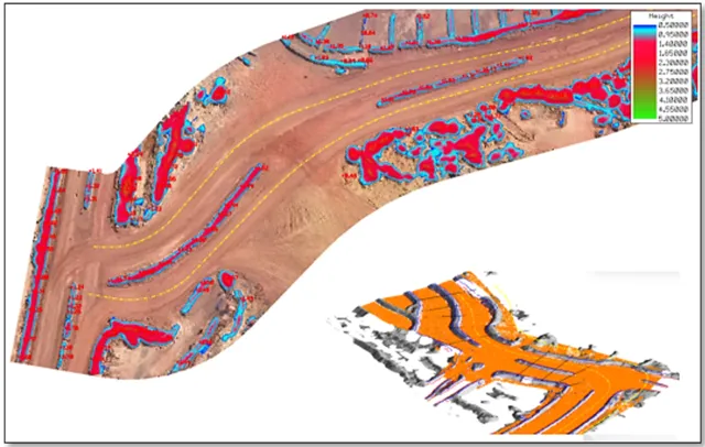
With additional functionality such as colour adjustment options, the creation of selection shapes for several object types or areas (e.g. buildings, water), the inclusion of vector models for true-ortho photo production, TerraPhoto lets you create ortho photos of good positional and colour-coordinated quality.


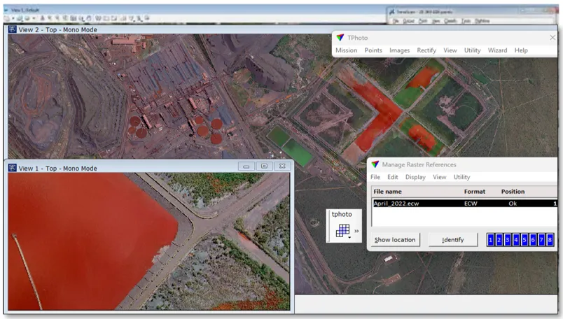
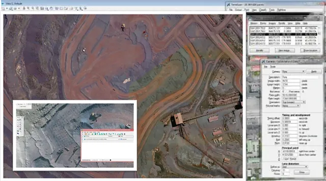
Besides starting a camera calibration from scratch, TerraPhoto is able to convert calibration files from several mobile and airborne systems into its own camera file format. It reads numerous image formats, such as ECW, GeoTIFF, TIF, BMP, CIT, COT, RLE, PIC, PCX, GIF, JPG2000 and PMG.


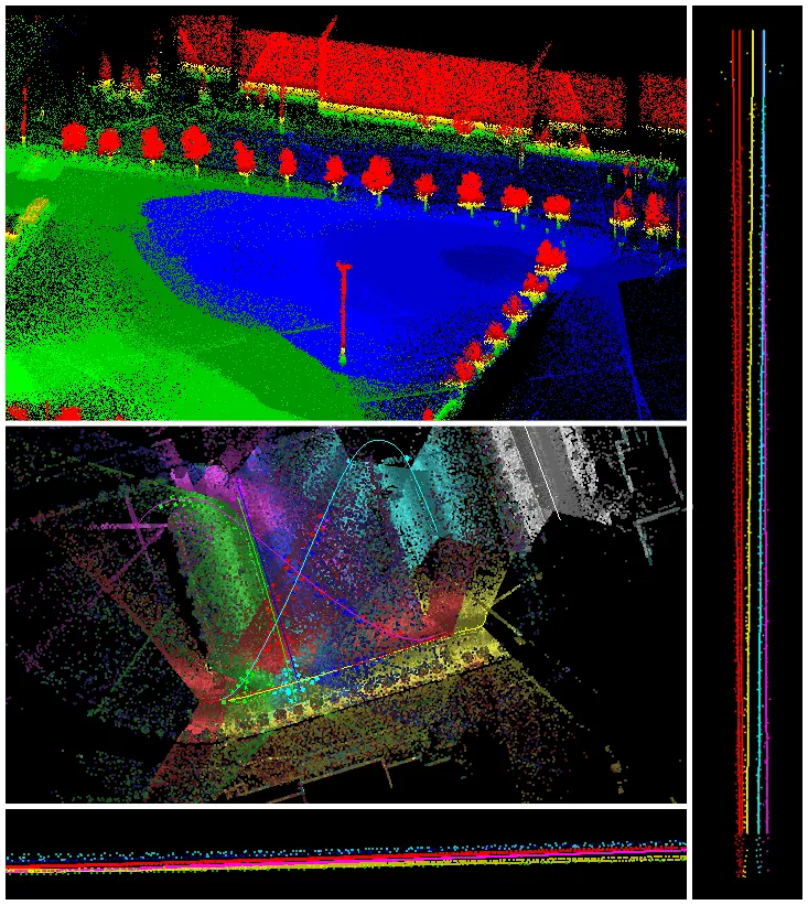
TerraPhoto offers many tools for visualizing laser and image data together, partly in combination with tools from TerraScan and TerraModeler. This includes the opportunity of draping ortho photos on a ground model or on building roofs, the creation of wall textures from horizontally-looking cameras of mobile or airborne systems, as well as the display of rendered views. With TerraPhoto you can also create fly-through animations from laser and image data in an easy and intuitive way. Finally, the extraction of colour values from images or ortho photos to laser points can be performed with TerraPhoto and TerraScan.

TerraBatch

Automate processing routines for large datasets.

Processing massive amounts of laser points and images can be a real challenge to a single PC. With TerraBatch you can distribute time- and resource-consuming tasks, such as TerraScan macro execution, to several PCs over a LAN freeing your own workstation for other processing steps.


Right to run TerraBatch on the same computer than TerraScan is included into TerraScan license giving you the ability to utilize the power of your computer 24×7.


Additional licenses can be purchased separately.


TerraBatch comes as stand-alone application with an easy-to-use graphical interface for managing tasks. Additional functionality includes the queuing of several tasks as well as a simple reporting system based on text files.

TerraStereo

Efficiently view, analyze, and extract features from 3D point clouds.

Services

Project Portfolios

Contact Us

Sales

Support

Address

Gauteng Office:

Graphic Engineering Solutions and Services (Pty) Ltd

Office E Building B, Lombardy Corporate Park, 1 Cole Road, Shere, 0084 Pretoria, South Africa

Postal Address:

PO Box 72236 Lynnwood Ridge, 0040 Pretoria, South Africa

About GESS

Legal Information

Follow Us

© 2024 by Graphic Engineering Solutions and Services (Pty) Ltd

Your cart is empty Continue
Shopping Cart
Subtotal:
Discount 
Discount 
View Details
- +
Sold Out